Pigeon Valley Hike From Goreme to Uchisar: Route, Distance and Transport
Pigeon Valley Hike From Goreme to Uchisar: Route, Distance and Transport
Visitor-friendly trail planning with realistic routes, transport and safety.
Affiliate disclosure: Some booking links may earn us a small commission at no extra cost to you. How our affiliate links work.
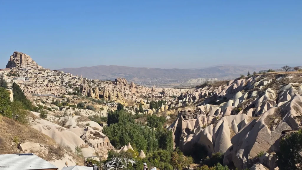
Pigeon Valley is a practical one-way hike between Goreme and Uchisar, usually described as roughly 3-4 kilometres and taking about two hours before stops. The valley is known for dovecotes carved into rock walls and for its connection to historic agriculture and vineyards. Walking toward Uchisar adds a climb at the end; walking toward Goreme generally finishes more gently. Confirm the correct entrance, carry offline navigation and arrange the return before starting.
Quick route facts
| Feature | Practical guidance |
|---|---|
| Route | Goreme-Uchisar or reverse |
| Approximate distance | About 3-4 km, depending on entrance and detours |
| Time | 1.5-3 hours plus Uchisar stops |
| Difficulty | Moderate due to loose ground, junctions and inclines |
| Best for | Town-to-town walk, dovecotes and first-time hikers |
Why is it called Pigeon Valley?
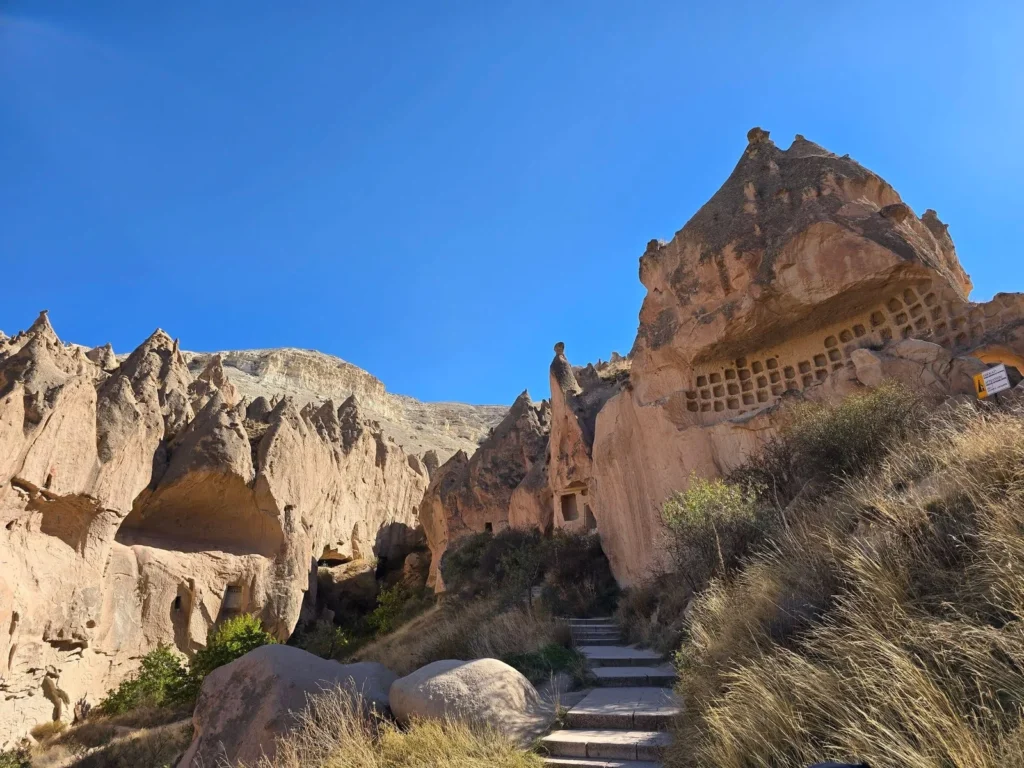
Residents carved dovecotes into the cliffs to attract pigeons and collect manure used in vineyards and fields. Decorative facades remain visible across the valley. This agricultural story makes the walk more meaningful than a simple connection between towns.
Goreme to Uchisar
This direction finishes with an ascent toward Uchisar. It suits hikers who want lunch, the castle panorama and a taxi return. Start from the correct lower entrance rather than a high roadside viewpoint. Save energy for the final climb and do not schedule the castle summit as compulsory.
Uchisar to Goreme
Starting in Uchisar allows breakfast or a castle-area view before descending toward Goreme. Many walkers find the overall direction easier, though loose downhill surfaces can challenge knees. It finishes near a broad selection of restaurants and hotels.
Trail features
Expect narrow erosion corridors, open plateau views, orchards, dovecotes and rock-cut spaces. Side paths lead to viewpoints or dead ends. Follow the intended track and avoid entering closed caves. Seasonal tea stops may operate, but carry your own water.
Adding Uchisar Castle
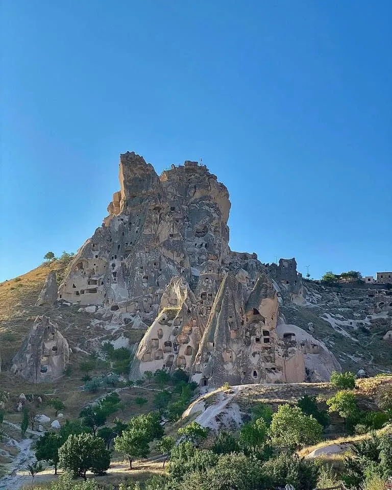
The castle provides a regional panorama but adds steep stairs and exposure. Decide after reaching town. Visitors with tired legs can use lower terraces and cafes instead. Check current opening and weather conditions before climbing.
Combining Love and White Valleys
Strong hikers can extend the day from Pigeon Valley through Uchisar into White and Love Valleys, creating a circuit back toward Goreme. The total commonly exceeds 10 kilometres and needs early start, navigation and more water. Do not improvise this extension late in the afternoon.
Transport
A taxi between Goreme and Uchisar is useful before or after the walk. Local minibuses may connect towns, but current schedules should be confirmed. If your hotel is high on the opposite side of Goreme, allow extra distance beyond the official-looking route.
Best time of day
Morning gives cooler temperatures and time to solve navigation. Late afternoon gives softer light but less margin before darkness. Sunrise balloon views are possible from upper areas, not guaranteed along the valley floor. Avoid the hottest summer hours.
Essential trail preparation
Download an offline map and mark the intended entrance, exit and road pickup before leaving the hotel. Cappadocia valleys have informal side paths, repeated names and several points described online as the main entrance. A screenshot of one pin is not a complete route. Tell someone where you are walking and the latest time you expect to finish.
Carry more water than the shortest estimate suggests, sun protection, a charged phone, a power bank, a small first-aid kit and layers. Wear closed shoes with tread. Loose volcanic tuff can behave like gravel on a slope, while shaded sections hold mud or ice after poor weather. Seasonal cafes cannot be treated as guaranteed water sources.
Weather and the best time to hike
Spring and autumn usually provide the most comfortable daytime walking, but rain can make tunnels, slopes and clay-like surfaces slippery. Summer hikers should start early, avoid exposed midday heat and carry extra water. Winter brings beautiful snow and quieter paths, but hidden ice, short daylight and closed seasonal facilities require a conservative route.
Check the forecast for the whole hiking window, not only the starting hour. Do not enter a narrow valley during heavy rain or thunder, and leave exposed ridges when storms approach. Strong wind affects balance near edges. A balloon cancellation does not automatically close trails, but it signals that conditions deserve careful review.
Trail navigation
Paint marks and signs exist in places but are not consistent enough to replace navigation. Track your progress and turn back before uncertainty becomes a late-day problem. Do not follow dogs, ATV tracks or another group without knowing their destination. Erosion can change paths between visits, and a route recorded years ago may cross a closed or damaged section.
Getting to trailheads and returning
Walking from Goreme works for several central valleys, but a taxi saves road walking and energy. Arrange a pickup before a one-way hike and identify a road-accessible meeting point. Mobile reception is not reliable in every corridor. Guided walks are valuable for complex junctions, hidden churches and visitors who do not want to manage transport.
If driving, park only in a permitted stable place without blocking residents, farms, tour vehicles or emergency access. Do not take a normal rental car onto rough tracks merely because an online map draws a road. After sunset, use a headlamp and a known exit rather than trying a shortcut.
Safety, families and solo hikers
Trail difficulty depends on the exact route, weather and confidence. Some sections include low tunnels, scrambles, steep loose climbs or unprotected drops. Families should choose a short defined route and supervise children closely. Strollers are unsuitable. Solo hikers should avoid unknown trails late in the day and share live plans when possible.
Do not enter fenced caves or unstable rooms. Rockfall and erosion are real. Keep away from ATV traffic, horses and balloon ground operations. If an injury occurs, move only when safe, share coordinates and contact emergency services; do not assume a valley cafe can provide rescue.
Responsible hiking
Stay on durable paths, carry rubbish out and never carve names into rock. Do not touch frescoes or light fires inside caves. Keep noise low around farms, homes, animals and places of worship. Ask before photographing residents or workers. The soft landscape is easily damaged, and responsible visitors protect the experience for the next person.
How to build the hike into your Cappadocia day
Give the trail its own place in the day instead of squeezing it between distant attractions. A comfortable plan includes breakfast, transport to the correct entrance, the hike, a flexible meal and one nearby viewpoint or town stop. A rushed schedule encourages wrong turns and makes every photo stop feel like a delay. If the walk ends in Goreme, use the evening for dinner or a hammam. If it ends in Uchisar, allow time for a terrace view before returning. Southern routes such as Ihlara need a full transport day and should not be paired with a late central-valley sunset unless a driver has confirmed the timing.
Keep the day after a balloon flight flexible. Flights require a very early start, and tired hikers make poorer decisions on loose ground. A short valley walk is realistic after breakfast; a long circuit may be better on another day. If the balloon is cancelled, do not automatically begin the longest route. First check why it was cancelled and whether wind, rain or visibility also affects walking.
Simple decision guide
- Choose a short out-and-back when time, weather or confidence is limited.
- Choose a one-way town-to-town route when you can confirm the finish and return transport.
- Choose a linked valley circuit only with a current track, early start and enough water.
- Choose a guided hike when history, navigation or family logistics matter more than independence.
Distances in Cappadocia are approximate because entrances, side paths and erosion change the line actually walked. Treat published figures as planning ranges, then compare them with a current map and local advice. The best route is not the one with the biggest number; it is the one you can complete safely while still enjoying the landscape.
What to eat after the hike
Plan a proper meal rather than relying only on trail snacks. Goreme is convenient after central valleys, Uchisar after Pigeon or White Valley, Avanos and Cavusin after northern routes, and the Ihlara villages after a gorge walk. Lentil soup, gozleme, manti, grilled dishes, yoghurt and local fruit products replace energy without needing a formal long dinner.
Compare guided hikes and transfers
Compare route length, pickup, group size, included equipment, recent reviews and cancellation terms for your dates.
Explore Cappadocia hiking activities ->
Affiliate disclosure: I may earn a commission at no extra cost to you.
FAQ
Which direction is easier?
Uchisar to Goreme often feels more downhill, but descent can affect knees. Choose according to your body.
Is the trail clearly marked?
Only partly. Carry an offline route and confirm the entrance.
Can I take a stroller?
No. Narrow, loose and uneven sections are unsuitable.
Can I return by taxi?
Yes from town. Arrange a pickup if finishing outside the centre.
Is Pigeon Valley suitable for beginners?
Active beginners can manage a planned one-way route in good weather, ideally with navigation or a guide.