Hiking in Cappadocia: Best Trails, Valleys, Distances & Difficulty Levels
Hiking in Cappadocia: Best Trails, Valleys, Distances & Difficulty Levels
A practical guide to choosing, reaching and safely walking Cappadocia’s most rewarding valleys.
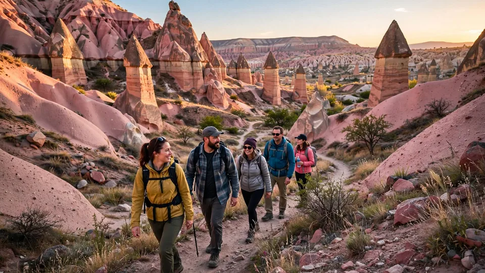
Hiking in Cappadocia takes you beyond the roadside viewpoints and into the valleys that shaped the region. From Goreme, walkers can reach Love Valley, Red Valley, Rose Valley, Pigeon Valley, Zemi Valley, Sword Valley and Meskendir Valley; Ihlara Valley is a separate full-day journey. This guide is for first-time hikers, photographers, couples and families who want realistic distances, difficulty levels, trailhead advice and safe route choices rather than a list of valley names.
Which Cappadocia hike should you choose?
Rose and Red Valleys give the best all-round combination of scenery, cave churches and sunset light. Pigeon Valley is the most useful town-to-town walk between Goreme and Uchisar. Love Valley suits distinctive fairy-chimney photography, while Ihlara Valley is the best long riverside walk. Choose by terrain, available daylight and transport—not only by distance.
Top Hiking Trails in Cappadocia
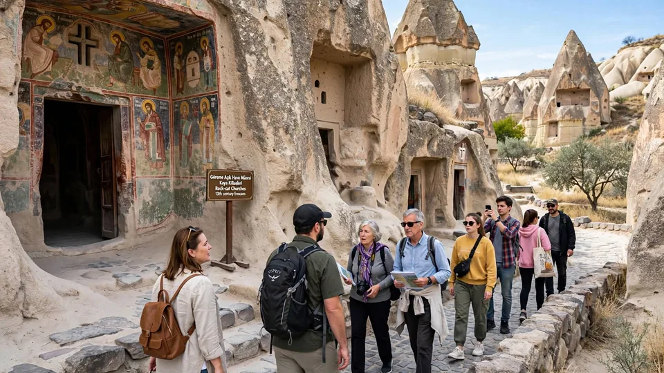
Distances and elevation figures below are approximate ranges because Cappadocia has multiple entrances, exits and unofficial side paths. Your chosen route can be much shorter or longer. Download the route you intend to follow and confirm the trailhead before leaving town.
| Trail | Location | Distance | Difficulty | Time | Best for | Highlights |
|---|---|---|---|---|---|---|
| Love Valley | Goreme–Uchisar area | 3–5 km | Moderate | 1.5–3 hr | Photography | Tall fairy chimneys, balloon views |
| Red Valley | Near Ortahisar | 3–6 km | Moderate | 2–3.5 hr | Sunset | Red ridges, viewpoints, cave paths |
| Rose Valley | Goreme–Cavusin | 4–7 km | Moderate | 2–4 hr | First-time hikers | Pink rock, churches, orchards |
| Pigeon Valley | Goreme–Uchisar | 4–5 km | Easy–moderate | 1.5–3 hr | Town-to-town walking | Dovecotes, Uchisar views |
| Ihlara Valley | Southwest Cappadocia | 3–14 km | Easy–moderate | 1.5–5 hr | Long nature days | River, shade, rock churches |
| Zemi Valley | South of Goreme | 5–7 km | Moderate | 2.5–4 hr | Quieter hiking | Orchards, tunnels, rock walls |
| Sword Valley | Near Goreme Open Air Museum | 2–3 km | Easy–moderate | 1–2 hr | Short adventures | Narrow formations, cave rooms |
| Meskendir Valley | Near Red/Rose Valleys | 4–6 km | Moderate | 2–3 hr | Connected routes | Tunnels, cliffs, hidden churches |
| Cavusin–Bozdag Ridge | Above Cavusin | 5–8 km | Moderate–hard | 3–5 hr | Experienced hikers | High panoramas, exposed ridge |
| Gomeda–Uzengi Valleys | Near Mustafapasa | 6–10 km | Moderate | 3–5 hr | Quiet landscapes | Rock churches, dovecotes, springs |
“Easy” does not mean paved or accessible. Even short routes may include loose gravel, uneven steps, low tunnels or steep entry paths. After rain or snow, an easy valley can become slippery and unsuitable.
Cappadocia Hiking Trails by Category
Shorter routes with flexible turnarounds
- Sword Valley short loop
- Pigeon Valley viewpoint section
- Ihlara riverside section from Belisirma
These work well when time is limited, but entrances can still be steep. Families should choose an out-and-back section so they can turn around when children have had enough.
The best choice for most visitors
- Rose Valley
- Red Valley
- Love Valley
- Zemi Valley
Expect rough surfaces, route choices and occasional scrambling. Two to four hours is realistic when you stop for photographs and churches.
Longer, exposed or difficult to navigate
- Cavusin–Bozdag ridge routes
- Full Ihlara Valley
- Long Rose–Red–Meskendir combination
These need more daylight, water and navigation confidence. Use a guide when you are not comfortable with exposed ground or unclear junctions.
Start early, but stay clear of operations
- Love Valley viewpoints
- Rose Valley entrances
- Cavusin lower trails
Balloon launch points and flight paths change with wind. Remain on public paths and never enter working launch or landing fields.
Plan the exit before enjoying the light
- Red Valley viewpoint route
- Rose Valley to Red Valley
- Uchisar end of Pigeon Valley
Carry a headlamp and finish near an agreed pickup point. Valley walls become dark earlier than open viewpoints.
Landscapes with changing light
- Love Valley fairy chimneys
- Rose and Red Valley ridges
- Ihlara river and churches
- Bozdag panoramas
Protect equipment from dust and avoid stepping backward near drops while composing a photograph.
Detailed Cappadocia Trail Guides
Rose Valley Trail
Rose Valley is the strongest first choice for hikers who want more than a viewpoint. Routes pass pale-pink ridges, orchards, rock-cut rooms and historic churches before linking toward Cavusin, Red Valley or Meskendir Valley. The challenge is navigation: paths split often and different maps use different names. Choose a defined start and finish rather than trying to “walk Rose Valley” without a route. Balloon views are possible near sunrise, but wind determines the flight line. In summer, start early or late because shade is limited. Near sunset, allow enough time to leave the valley floor before darkness.
Red Valley Trail
Red Valley is famous for colour at the end of the day, but the walking experience begins below the busy sunset viewpoint. Narrow tracks move between ridges, cave openings and small agricultural plots, and routes can connect with Rose Valley and Meskendir. Loose descents are the main difficulty. If sunset is your goal, begin with a shorter route and finish at the road viewpoint; do not start a complicated valley crossing close to dark. Parking becomes congested near sunset, so a taxi pickup or guided walk can be simpler. Carry a light even when you expect to finish before the sun disappears.
Love Valley Trail
Love Valley’s tall fairy chimneys create one of Cappadocia’s most recognisable walking landscapes. The valley floor is generally more comfortable than its steeper access tracks, which can be dusty and slippery. A viewpoint visit and a full valley hike are different experiences, so confirm which entrance your driver understands. Sunrise may bring balloons into the wider landscape, but the direction changes every morning and no angle is guaranteed. There is little reliable shade or water. Avoid midday in hot weather, stay on established ground around fragile formations and arrange your return before beginning a one-way route.
Pigeon Valley Trail
Pigeon Valley connects Goreme and Uchisar, making it one of the easiest routes to combine with a town visit. Carved dovecotes explain the valley’s name, while the Uchisar end gives strong views toward the castle. Direction matters: walking toward Goreme generally finishes lower, while walking toward Uchisar adds a climb. Entrances and side paths can be confusing, and recent rain turns clay into a slippery surface. Walk one way and return by taxi or local transport rather than retracing the trail. Families can use a shorter out-and-back section, but supervise children around eroded edges and cave openings.
Ihlara Valley Trail
Ihlara Valley is a green river canyon far from Goreme, not a quick central Cappadocia walk. Multiple entrances allow anything from a short riverside section to a long point-to-point hike. The well-known staircase entrance adds a substantial descent and climb unless transport meets you elsewhere. Rock-cut churches, trees and the Melendiz River give the route a different atmosphere from Rose or Love Valley. Use a tour, driver or rental car and agree on the exit before starting. Wet stones can be slippery, and the full route needs enough time for church stops, lunch and the return journey.
Zemi Valley Trail
Zemi Valley offers a quieter alternative close to Goreme, with orchards, high rock walls, cave spaces and occasional tunnels. The route can feel more enclosed than the open ridges of Red Valley. Conditions change after rain because vegetation, mud and water can affect narrow sections. Some walkers use Zemi as a one-way descent toward Goreme, but finding the correct upper entrance requires planning. Bring an offline track and do not enter dark, unstable side tunnels simply because they look like part of the route. It is better for confident independent walkers or visitors with a guide than for a rushed first hike.
Sword Valley Trail
Sword Valley, close to Goreme Open Air Museum, fits travellers who want a shorter walk among narrow rock shapes and cave rooms. Short distance does not remove route-finding problems: informal tracks cross the valley and some passages are low or uneven. It works well as an introduction before a museum visit or as part of a guided combination with nearby valleys. Wear proper shoes and avoid climbing unstable interiors. At sunrise, balloons may appear in the broader sky, but walkers must keep away from vehicles and crews using nearby fields. Turn back if mud, ice or darkness makes a narrow section unsafe.
Meskendir Valley Trail
Meskendir is often used as an entrance or exit for a longer Rose and Red Valley route. The trail passes rock walls, tunnels, dovecotes and less obvious historic spaces, giving it an adventurous feel without requiring a high ridge. Its shaded or enclosed sections can stay wet and slippery after poor weather. Check whether your planned combination is a loop or a one-way hike, because finishing several kilometres from your vehicle is a common planning mistake. A guide adds value here by explaining the churches and selecting the safest current connections. Carry a headlamp for tunnels, but never enter a closed or unstable passage.
Cavusin–Bozdag Ridge
Routes above Cavusin climb toward open ridges with broad views over northern and central Cappadocia. The reward is space and perspective; the cost is exposure to wind, sun and unprotected drops. Tracks vary and are not a single standard marked trail, so this is not the best choice for a first independent walk. Use a reliable offline route or a local hiking guide, avoid the ridge in strong wind, and turn back before cloud, rain or fading light removes visual landmarks. Sunrise photography can be impressive, but begin only when you know the approach and can stay clear of balloon operations.
Gomeda and Uzengi Valleys
Gomeda and Uzengi, near Mustafapasa, suit repeat visitors and walkers who want quieter scenery away from Cappadocia’s most photographed central valleys. Expect dovecotes, churches, rock walls, agricultural land and mineral-water features rather than constant balloon views. The route is less convenient without a car, and trail information can be inconsistent. Arrange transport at both ends or choose a guided loop. Seasonal vegetation and water can complicate passages, while summer heat makes exposed connections tiring. Treat the distance as a half-day commitment and carry everything you need; facilities are not available along every section.
Would a guided hike make your day easier?
A guide is most valuable when routes connect several valleys, church history matters or you need transport between different trailheads. Compare the exact route, duration, group size, pickup and included equipment before booking.
Compare Cappadocia hiking tours →
Affiliate disclosure: I may earn a small commission at no extra cost to you.
Cappadocia Trail Map, Starts and Distances
There is no single entrance for several valleys. The table describes common planning areas, not precise GPS instructions. Confirm your exact start pin with your hotel, driver or guide and save it offline.
| Trail | Common start area | From central Goreme | Typical walk | Best access |
|---|---|---|---|---|
| Rose / Red / Meskendir | Goreme–Cavusin or Red Valley road | About 5–10 km by road | 2–5 hr | Taxi, car or guided transfer |
| Pigeon Valley | Goreme or Uchisar | Walkable/taxi depending direction | 1.5–3 hr | Walk one way; taxi back |
| Love Valley | Lower valley or upper viewpoint area | About 4–6 km by road | 1.5–3 hr | Taxi or car |
| Zemi Valley | South Goreme or upper road entrance | About 2–6 km | 2.5–4 hr | Walk/taxi; confirm upper pin |
| Sword Valley | Near Goreme Open Air Museum road | About 2 km | 1–2 hr | Walk or short taxi |
| Ihlara Valley | Ihlara village, main stairs or Belisirma | About 80 km by road | 1.5–5 hr | Tour, driver or rental car |
| Gomeda / Uzengi | Mustafapasa area | About 15–20 km by road | 3–5 hr | Car, taxi or guide |
How to Reach Cappadocia Hiking Trails
Goreme is the most practical base for central valleys, but trailheads are not all beside town. For a one-way hike, book a taxi to the start or arrange collection at the finish and exchange a map pin with the driver. Rental cars suit loops but can leave you walking back to the parking place. Tours are easiest for Ihlara Valley and guided multi-valley routes.
Compare guided routes and transfers →
Affiliate disclosure: if you book through this link, I may earn a small commission at no extra cost to you.
Best Time of Year to Hike in Cappadocia
Spring
Usually the best combination of mild temperatures and greener valleys. Rain can create deep mud and slippery clay, so check conditions after storms.
Summer
Start close to sunrise, carry extra water and avoid exposed midday routes. Shade is limited in Love, Rose and Red Valleys.
Autumn
Excellent for photography and comfortable walking. Mornings become cold later in the season, so bring layers and watch shortening daylight.
Winter
Snow can transform the views, but ice hides edges and shaded paths stay slippery. Choose short routes and follow current local advice.
Best time of day: morning is safest for longer walks because you have more daylight and cooler temperatures. Late afternoon suits Red and Rose Valleys, but only when your exit is simple and you carry a light. Weather, not the month alone, should decide the final route.
Cappadocia Hiking Safety and Local Tips
- Check the weather: heavy rain can cause fast water, mud and falling debris in narrow valleys. Strong wind makes exposed ridges unsafe.
- Expect limited markings: painted arrows and signs are inconsistent. Save an offline map and a specific start and finish.
- Carry your own water: fountains and cafes are seasonal or absent. Do not plan around finding water inside a valley.
- Wear shoes with grip: smooth trainers struggle on dust, loose gravel, clay and snow.
- Respect balloon operations: do not enter launch or landing fields, approach baskets or block crew vehicles.
- Avoid peak heat: in summer, begin early, cover your head and turn around before your water is half gone.
- Be careful alone: tell your hotel your route and return time. Avoid remote ridges and uncertain tunnels without company.
- Protect the landscape: do not enter closed caves, touch frescoes, climb fragile formations or leave the path for a photograph.
Cappadocia Hiking Gear Checklist
Hiking in Cappadocia: FAQ
What are the best hikes in Cappadocia?
Rose and Red Valleys offer the best all-round first hike. Pigeon Valley is useful between Goreme and Uchisar, Love Valley is strongest for fairy-chimney photography, and Ihlara Valley suits a longer riverside day.
Are Cappadocia hikes safe?
Popular routes can be walked safely with preparation, but paths are natural and conditions change. Loose gravel, heat, mud, ice, unprotected drops and unclear junctions are real risks. Match the route to the day’s weather and your ability.
Do I need a hiking guide?
Not for every short route. A guide is valuable for linked valleys, hidden churches, uncertain trailheads, winter conditions or travellers who do not want to manage navigation and return transport.
What is the best time of day to hike?
Morning is best for longer hikes and summer walks. Late afternoon gives beautiful light in Rose and Red Valleys, but you must know the exit, carry a light and avoid being inside the valley after dark.
Can I hike while balloons are flying?
Yes, from safe public trails and viewpoints. Balloons do not follow one guaranteed route. Never enter operational launch or landing areas, cross in front of crew vehicles or approach a basket without permission.
How long are the main Cappadocia trails?
Most central valley walks take about two to four hours, depending on entrances and stops. Short sections can take one hour, while long Ihlara or multi-valley routes can require most of a day.
Are Cappadocia hiking trails marked?
Some sections have signs or painted arrows, but markings are not consistent enough to use alone. Download an offline route and confirm the exact trailhead with a hotel, driver or guide.
Is hiking in Cappadocia suitable for children?
Short out-and-back sections can suit active children with close supervision. Avoid exposed ridges, long heat, dark tunnels and slippery routes. Choose a path where the family can turn around easily.
Can I hike Cappadocia without a car?
Yes. Stay in Goreme, walk selected nearby routes and use taxis for one-way hikes. A tour or driver is more practical for Ihlara Valley and remote southern trailheads.
Plan a Better Cappadocia Hike
For a first hike, choose Rose and Red Valleys for scenery, Pigeon Valley for a practical Goreme–Uchisar walk or Love Valley for fairy-chimney photography. Walk in the morning for cooler temperatures and more daylight; use late afternoon only when you know the exit. Distances vary with the chosen entrance, so save a route, arrange transport and carry water. Good shoes, weather awareness and a flexible turnaround time matter more than completing the longest trail.